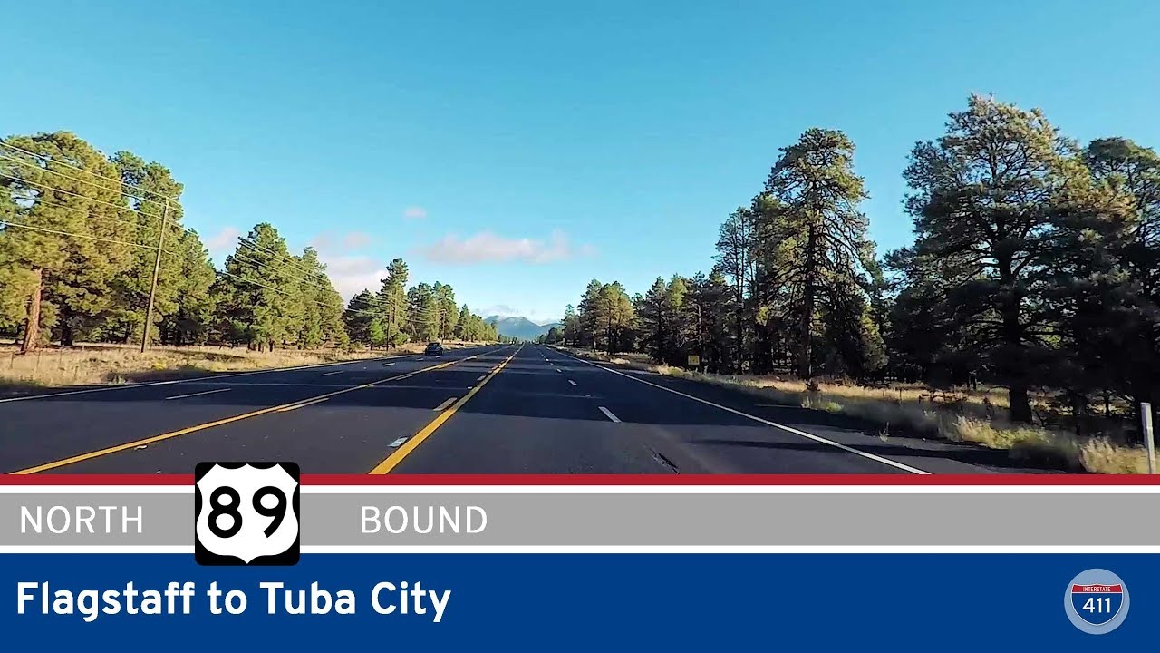
Take a winding desert drive through northern Arizona as we follow U.S. Route 89 from Flagstaff to Tuba City—a 67-mile journey that transitions from high pine forests to stark, sun-scorched mesas and painted deserts. Along the way, we’ll brush up against ancient volcanic fields, pass Navajo communities, and cross the Little Colorado River on a route that is as remote as it is unforgettable.
We begin our trip in Flagstaff, nestled among the ponderosa pines and the San Francisco Peaks at nearly 7,000 feet above sea level. Heading north on U.S. 89, the road quickly sheds the cool, forested feel of the city and opens up to wide, sloping grasslands dotted with juniper and volcanic remnants. Not far from town, we take a brief detour east onto Sunset Crater-Wupatki Loop Road, a scenic side trip that leads toward Sunset Crater Volcano National Monument. This surreal landscape of black lava fields and cinder cones offers a haunting glimpse into Arizona’s geologic past before we return to the main highway to continue north.
Back on U.S. 89, we descend steadily out of the pine highlands and into the drier, open spaces of the Colorado Plateau. Around us, the earth flattens and reddens, with sandstone bluffs and sweeping views of an ancient, weather-carved landscape. After about 45 miles, we pass through Gray Mountain, a small outpost with a gas station and few remaining structures, once busier during the heyday of regional uranium transport. Continuing north, we soon enter Cameron, a vital crossroad and service hub for travelers and residents alike. Here, U.S. 89 intersects with Arizona Highway 64, the eastern gateway to the Grand Canyon’s South Rim, and a recently constructed roundabout facilitates the growing flow of tourists. If you need fuel, snacks, or a bathroom break, this is your last real chance before Page or Tuba City—a full hour in either direction.
Beyond Cameron, the route crosses the Little Colorado River via a narrow canyon, marking a striking geographical transition as the road pushes deeper into Navajo Nation lands. The terrain grows even more austere, marked by wind-blown rock, plateaus, and occasional flashes of desert greenery. This stretch of road feels almost timeless, with few man-made intrusions and sweeping horizons that inspire reflection. After about 15 miles of quiet solitude, we reach the major junction with U.S. Route 160, where we turn east toward Tuba City. The final leg brings us to the western edge of town, where this segment ends amid the subtle bustle of one of the largest communities in the Navajo Nation.
This journey along U.S. 89 is more than a drive—it’s a meditation on space and time in the American Southwest. From the volcanic drama near Flagstaff to the arid majesty of the high desert, this route invites us to slow down, take in the stark beauty, and appreciate the stillness that defines this part of Arizona.
🗺️ Route Map

0 Comments