Take a scenic 9-mile drive along Arkansas Highway 46 from Sheridan to Jenkins Ferry State Park. Discover peaceful forests, rural charm, and the haunting history of a Civil War battlefield tucked away in Grant County, Arkansas.

Explore America’s diverse network of state highways—regional routes managed by individual states that connect towns, cities, parks, and scenic landscapes.
State highways form the backbone of regional travel across the United States, offering essential connections between cities, rural communities, and major national routes. Managed by individual state departments of transportation, these highways vary widely in scale—from narrow rural byways to multi-lane expressways rivaling interstates in traffic and speed. While numbering systems and signage conventions differ from state to state, each network plays a critical role in local mobility and economic development.
Unlike the federally designated Interstate and U.S. Highway systems, state highways are developed and maintained at the state level, giving them a unique character and flexibility. Some follow historic paths and scenic corridors, while others serve as modern commuter routes or urban spurs. Many are vital links to state parks, natural attractions, and lesser-known destinations that don’t fall within the national systems.
On this site, we highlight a growing collection of notable state highways, organized by region and state. Whether you’re tracing a scenic loop through the mountains, navigating a fast-moving corridor through a metro area, or exploring forgotten rural routes, our guides offer detailed overviews, and video journeys to help you plan your next adventure.
State Departments of Transportation use different terminology for their designated road systems, with some states using “state highway,” others “state road,” and still others “state route.” These distinctions, though seemingly minor, often reflect historical and legislative traditions within each state. The choice of a particular term can be tied to the legal language used when the road network was first established or expanded. For example, a state might have initially defined its network as a “system of highways” for commerce and travel, while another may have focused on creating a “system of roads” for local and inter-city connections. The term “state route” is often a more modern designation that emphasizes a specific numbered path for navigation rather than the physical characteristics or purpose of the road itself. While the exact reasoning for each state’s choice is complex and rooted in its unique history, the map on the right provides a visual guide to which term is used where.

Take a scenic 9-mile drive along Arkansas Highway 46 from Sheridan to Jenkins Ferry State Park. Discover peaceful forests, rural charm, and the haunting history of a Civil War battlefield tucked away in Grant County, Arkansas.

Take a scenic journey across the Missouri Ozarks on State Route 86 from Eagle Rock to Branson. This 32-mile drive explores lake valleys, wooded ridges, and charming backroads before ending just south of Missouri’s entertainment capital.

Take a quiet, scenic ride across the Arkansas-Missouri border on Missouri Supplemental Route P, a 1-mile connector between Highway 23 and Route 86 near Eagle Rock. Discover this peaceful Ozark backroad and its ties to lakeside communities and hidden retreats.

Drive 2.5 miles along Kentucky Route 998 (Olivet Church Road) in Paducah, Kentucky, connecting U.S. Highways 60 and 62 through a mix of suburban growth and rural charm.
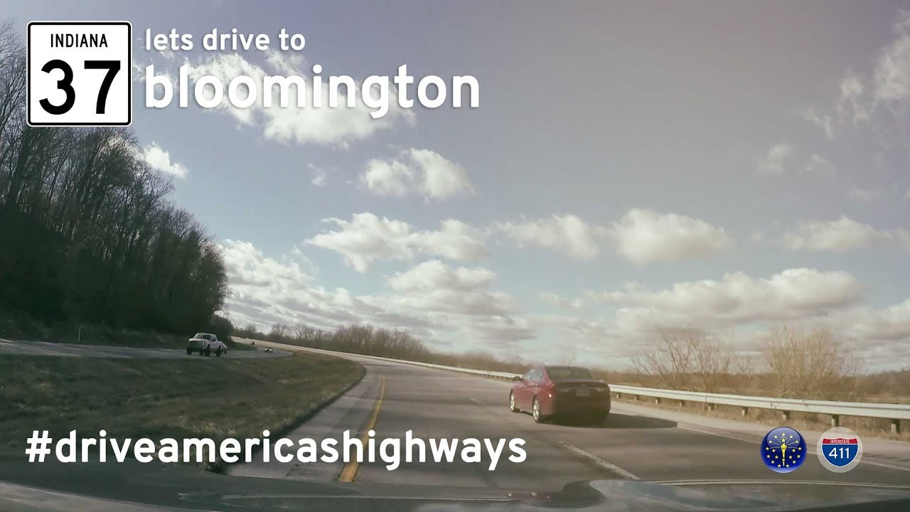
Drive 48 miles along Indiana State Road 37 from Indianapolis to Bloomington—capturing a now-lost version of the highway before its full transformation into Interstate 69.
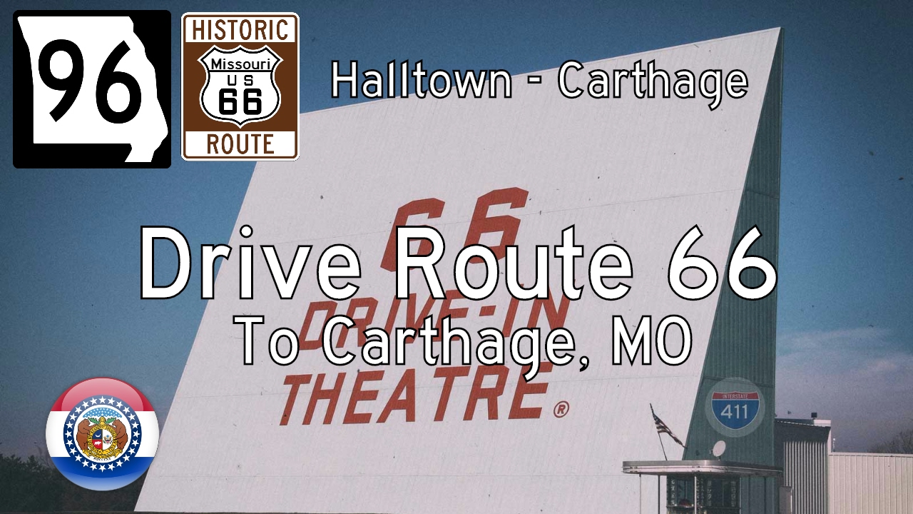
Take a scenic ride across the heart of the Missouri Ozarks as we follow a quietly iconic stretch of Missouri Route 96, a modern roadway bearing the spirit and path of Historic Route 66. Our 41-mile journey begins at Halltown, where this local highway picks up the…

Explore Missouri Routes 13 and 413 in Springfield, Missouri, with this short but essential city drive. We travel north on MO-13 from US-60 before continuing west on MO-413 to the MO-360/US-60 interchange.

Cruise 8.5 miles south on the Dallas North Tollway from Plano to I-635 in Dallas. Explore the Tollway’s transition from suburb to city with exits at Willow Bend, Addison, and the Galleria.

Drive westbound along Texas Highway 366 (Woodall Rodgers Freeway) through the heart of downtown Dallas, Texas, passing landmarks like Klyde Warren Park and the Dallas Arts District on this short but iconic 1.5-mile stretch from US-75 to I-35E.
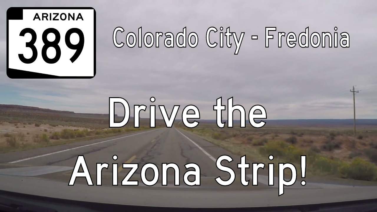
Explore Arizona’s remote high desert with a drive along State Route 389 from Colorado City to Fredonia. This 32.5-mile route through the Arizona Strip showcases sweeping vistas, historic stops like Pipe Spring National Monument, and stunning views of Vermilion Cliffs.

Travel Utah Route 59 from Hurricane to the Arizona border in Colorado City on a 22-mile desert drive through the remote and scenic Arizona Strip. Discover quiet towns, dramatic red cliffs, and the rich, complex history of the region.
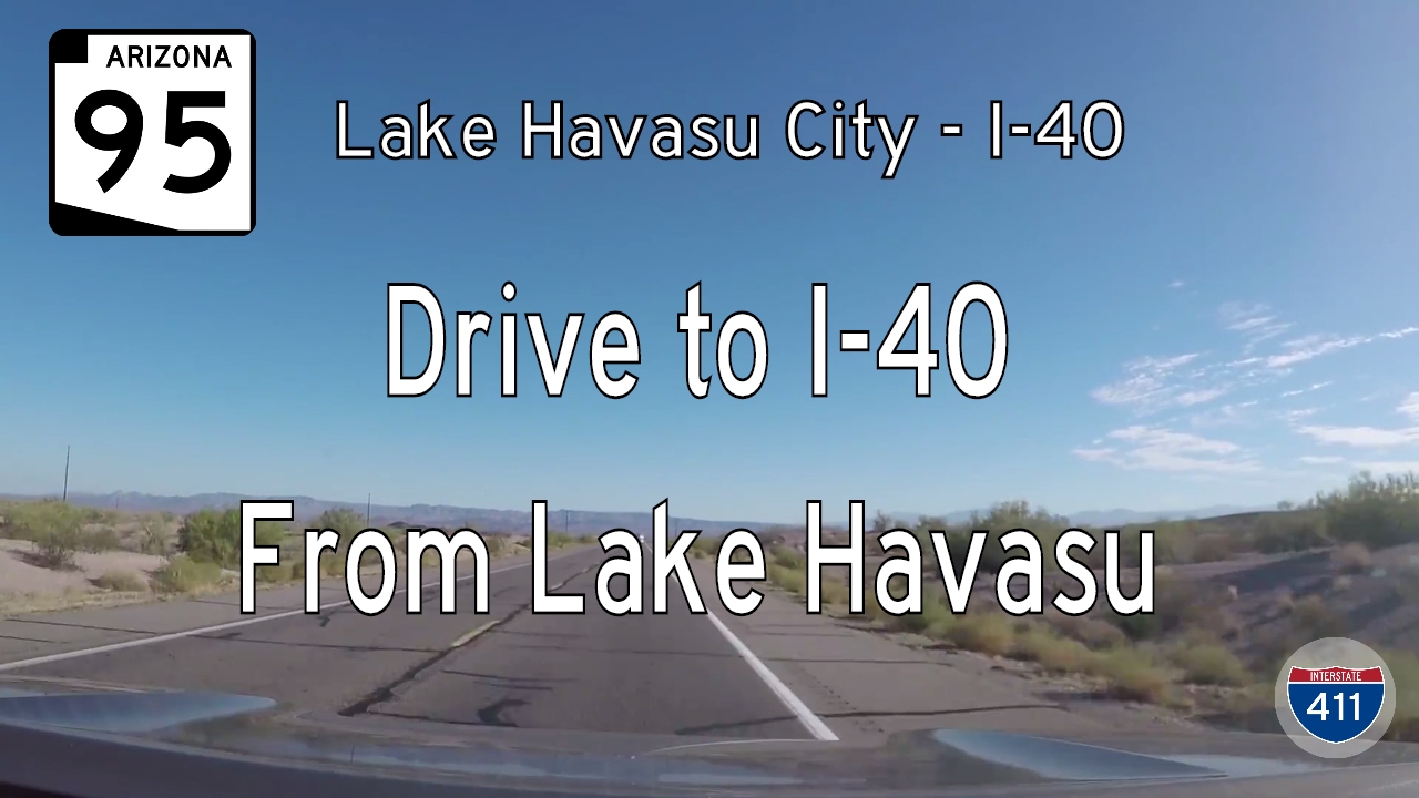
Drive 19 sun-soaked miles along Arizona State Route 95 from Lake Havasu City to Interstate 40. Explore desert vistas, lakeside charm, and quiet stretches of the Colorado River basin on this underrated southwestern route.