Interstate 630—known locally as the Wilbur D. Mills Freeway—is one of Little Rock’s most important urban expressways. Running directly through the heart of Arkansas’s capital city, I-630 forms a critical east-west spine that links downtown Little Rock to its growing western suburbs. In this drive, we head westbound for 8 miles from Interstate 30 to Interstate 430, passing through a mix of historic neighborhoods, medical hubs, and thriving commercial districts.
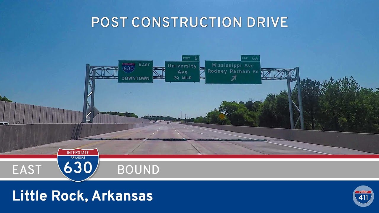
We begin our journey at the eastern terminus of I-630, merging from the eastbound ramp of Interstate 30 just outside downtown Little Rock. Almost immediately, we’re immersed in the city core. One of the first exits is Broadway Avenue, which connects to the River Market District and is part of an unsigned alignment of US-70—a nod to the city’s highway past. Just beyond, we skirt the southern edge of downtown and pass close to the Arkansas State Capitol, one of Little Rock’s most recognizable landmarks.
As we continue west, the corridor takes us past the Martin Luther King Jr. Drive interchange, where Arkansas Children’s Hospital comes into view. Just west of here, we cross over a major rail line and pick up speed as the urban density begins to shift. Woodrow Street is next, followed closely by the Pine and Cedar Street interchanges that directly serve UAMS and nearby residential neighborhoods.
From here, Interstate 630 enters the Midtown area—an eclectic blend of old and new development, home to longtime Little Rock residents as well as students and professionals. The Fair Park Boulevard exit offers access to War Memorial Park and the Little Rock Zoo, both situated just north of the freeway. It’s a great place to stretch your legs if you’re looking for a family-friendly stop. Just west of here, the freeway widens to eight lanes, reflecting its role as a commuter-heavy route for thousands of west Little Rock residents.
After crossing University Avenue—one of the busiest interchanges on the route—we pass Baptist Health Medical Center and the shopping zones around Barrow Road. At this point, the scenery becomes increasingly suburban. The Mississippi Avenue interchange provides access to residential neighborhoods and medical offices, while Barrow Road leads to retail strips and restaurants. Just a few minutes later, we pass the final exit at Shackleford Road before Interstate 630 ends at its western terminus, merging with Interstate 430, a bypass loop around the city.
This westbound drive on I-630 showcases just how much Little Rock has evolved. From the governmental core of downtown to the tree-lined suburbs of the west side, the route is a microcosm of the city’s identity. Whether you’re commuting, exploring, or passing through, Interstate 630 offers an efficient and revealing look at the capital city.
🗺️ Route Map
0 Comments