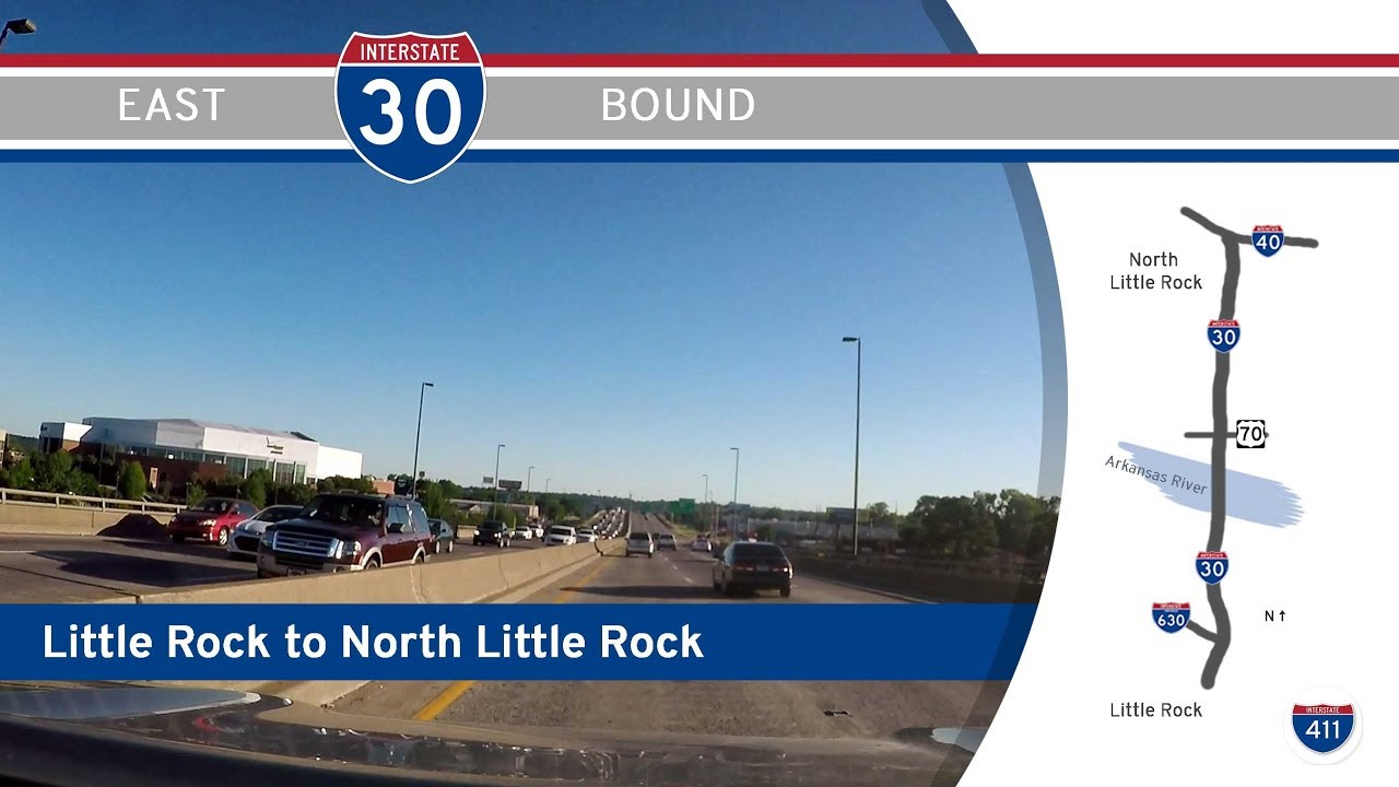
Take a quick but captivating drive across the heart of Arkansas’s capital as we follow the pre-reconstruction alignment of Interstate 30 from Little Rock to North Little Rock. This short but historically significant stretch offers a glimpse into the old downtown freeway corridor before the sweeping changes of the 30Crossing project. For locals and road enthusiasts alike, it’s a snapshot of what the city’s skyline looked like before the bulldozers arrived.
We begin our journey on the eastbound lanes of Interstate 30, merging in from Interstate 630 in the middle of downtown Little Rock. Here, the urban skyline surrounds us on both sides, with the prominent office towers of downtown just to our west and the Arkansas River awaiting us ahead. This section of highway, sunken below the surrounding city blocks, once formed the main artery funneling traffic through the heart of the capital. We quickly encounter the interchange with Arkansas Highway 10, known locally as Cantrell Road, offering a brief but scenic view toward the River Market District, the Clinton Presidential Library, and the bridges spanning the river.
Crossing the Arkansas River on the I-30 bridge, we leave Little Rock behind and enter North Little Rock, gliding over the historic riverfront area. To our right, the riverbank hosts the Clinton Presidential Library, while to our left, the Broadway Bridge provides an alternate route into downtown. The river crossing offers panoramic views of both cities, a favorite moment for commuters before the alignment was altered.
Once in North Little Rock, the surroundings quickly shift from urban core to a more industrial and commercial landscape. We pass the exit for U.S. Highway 70, locally known as Broadway, which once served as the primary gateway to downtown North Little Rock. Continuing just a short distance beyond, Interstate 30 reaches its eastern terminus at the sprawling interchange with Interstate 40. This junction disperses traffic north toward Conway and west-central Arkansas, and east toward Memphis. Here, our brief three-mile drive comes to an end, a farewell to an alignment that served as a defining feature of the downtown corridor for decades.
This drive is more than just a quick jaunt over the river—it’s a “Lost Highway” moment, a record of the infrastructure that shaped how locals navigated their capital city. The sweeping views, compact corridor, and historic bridges remind us how urban landscapes evolve, leaving behind memories of the roads that once were.
🗺️ Route Map
0 Comments