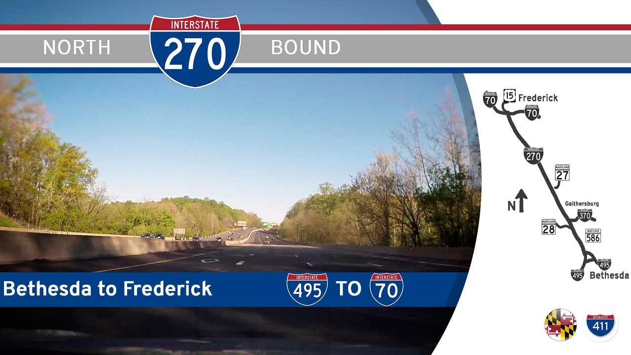
Take a scenic ride out of the nation’s capital region as we follow the 31-mile stretch of Interstate 270 from Bethesda to Frederick, Maryland. This corridor, known locally as the Washington National Pike, blends urban bustle, suburban sprawl, and rural tranquility, offering a unique glimpse into the changing landscapes that define central Maryland.
Our journey begins just outside the Capital Beltway (I-495), as we merge onto the I-270 spur near Bethesda. Immediately, the rhythm of the highway picks up pace, serving as a major commuter route for those shuttling between the city and its northwestern suburbs. High-rise office buildings, modern apartment complexes, and park-and-ride facilities quickly come into view, signaling our proximity to the busy commercial hubs of Bethesda and North Bethesda. Almost immediately, we see signs for Rockville, one of Maryland’s fastest-growing cities, famous for its government offices and biotechnology firms. Here, I-270 widens considerably, reflecting its role as a key artery for the bustling Montgomery County suburbs. The exits come in quick succession, serving major thoroughfares like Montrose Road and Shady Grove Road, funneling commuters to dense residential neighborhoods, shopping centers, and tech corridors that line the western edges of the Washington metropolitan area.
As we continue northwest, the landscape begins to shift. The interchanges space out and the surrounding environment transforms from dense suburbia to a more relaxed, semi-rural feel. Passing Gaithersburg, with its mix of modern development and historic charm, we briefly travel alongside the Shady Grove Metro station—the northwestern terminus of the Washington Metro’s Red Line. Beyond Gaithersburg, Clarksburg greets us with sweeping views of master-planned communities and large green spaces, like the nearby Little Bennett Regional Park, offering a peaceful retreat from urban life. Traffic often thins a bit here, giving us a chance to settle into the rolling terrain and broadening vistas as the road gradually begins its ascent toward the Monocacy River valley. Just before reaching Frederick County, a well-marked exit guides travelers to the Monocacy National Battlefield, commemorating a pivotal Civil War engagement. We make a brief detour here, pausing at the scenic overlook near the battlefield—a tranquil spot where history feels tangibly close amidst the pastoral backdrop.
Back on the mainline of I-270, the highway narrows slightly as it approaches its final miles. The pace slows, not because of traffic, but because the character of the route transitions from expressway to something more grounded in the landscape. The fields widen, the suburban developments give way to open farmland, and the Blue Ridge foothills appear faintly on the horizon. Finally, we enter Frederick—a city blending historical significance with modern vibrancy. The highway meets its northern terminus at a sprawling interchange with Interstate 70, where travelers must choose between heading east toward Baltimore or west into the Appalachian highlands. Our drive concludes here, at the confluence of transportation history and modern mobility, having witnessed Maryland’s dramatic shift from metropolitan edge to rural heartland.
Interstate 270 offers more than just a route between point A and point B—it’s a narrative of growth, history, and evolving landscapes. From urban towers to battlefield fields, every mile of this highway tells a story of Maryland’s rich cultural and geographic diversity. Whether you’re a daily commuter or a cross-country traveler, this stretch offers a memorable ride through some of the most iconic corridors of the Mid-Atlantic.
🗺️ Route Map
0 Comments