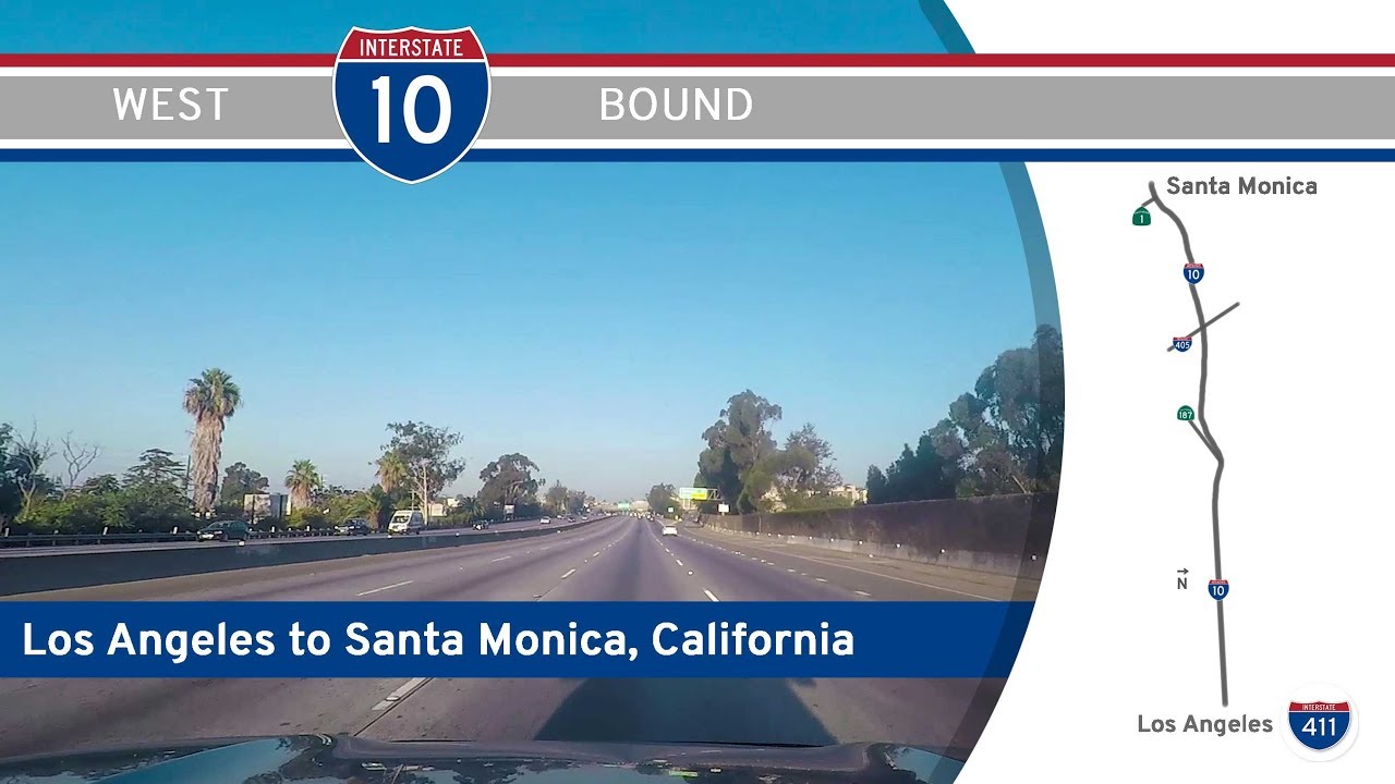
Take a westward cruise across the heart of Los Angeles as we follow Interstate 10—the Santa Monica Freeway—on its final 13-mile stretch from downtown LA to the Pacific Ocean. This journey, while urban at its core, is layered with cultural texture, dense infrastructure, and a palpable transition from skyscraper canyons to ocean breezes. From freeway overpasses to palm-lined boulevards, this drive is more than just a connection—it’s the capstone of one of America’s great transcontinental routes: the Christopher Columbus Transcontinental Highway.
We begin our drive just west of downtown Los Angeles, merging onto Interstate 10 from the massive interchange with Interstate 110 and the Arroyo Seco Parkway. The skyline looms just behind us as we pass through a concrete corridor flanked by towering sound walls, graffiti-tagged overpasses, and the ubiquitous glow of urban energy. On this segment, I-10 carries the weight of commuter traffic and the stories of millions who’ve used it daily. Passing the exits for Western Avenue, Crenshaw Boulevard, and La Brea Avenue, we weave through neighborhoods that have seen the city rise, fall, and rise again—from Koreatown to Mid-City, each with its own unique rhythm.
Soon, we reach Culver City via the interchange with California Highway 187 (Venice Boulevard), and with that, a perceptible change sets in. The freeway here flattens out slightly, and the skyline recedes as we pass through a more residential and commercial blend. Tech campuses and creative studios are tucked away behind exit signs—this is “Silicon Beach” territory, where entertainment and innovation meet. As we approach the giant interchange with Interstate 405, the traffic thickens—no surprise, as this is one of the busiest freeway crossings in the world. Yet just beyond this tangled junction lies a surprising reward: the final few miles into Santa Monica.
Crossing Centinela Avenue, we officially enter the city of Santa Monica, and with it, a dramatic shift in air and light. The dense grid of Los Angeles gives way to ocean air, wider skies, and the anticipation of open water. The buildings shrink, the palms get taller, and the end of the road feels near. We glide past the final exits—20th Street, Cloverfield Boulevard—and then, almost suddenly, the freeway ends. The last few hundred yards of Interstate 10 transition into California Highway 1, also known as Pacific Coast Highway (PCH). As we exit, the Santa Monica Pier looms just ahead to our right—a cultural icon and fitting bookend to this journey. The western terminus of I-10 isn’t just a dead-end; it’s a symbolic gateway, where cross-country ambition meets the edge of the Pacific.
This drive, though short in distance, encapsulates the incredible diversity of Los Angeles: from the relentless energy of its downtown core to the laid-back ethos of its coastal communities. More than just an urban commute, it’s a closing chapter to a highway that began thousands of miles east and ends just feet from the surf. In a city often defined by motion, this is where the westbound dream finally rests.
🗺️ Route Map
0 Comments