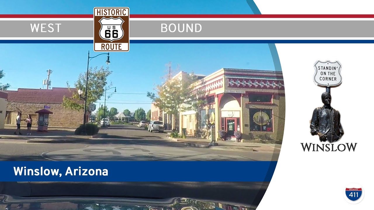
Drive America’s Highways for 3 miles west along the historic mother road in Winslow, Arizona 🏜️
Take a nostalgic cruise through the heart of small-town America as we follow Historic Route 66 through Winslow, Arizona. This brief but unforgettable three-mile stretch winds its way past weathered brick buildings, classic neon signs, and the kind of Americana that inspired generations of travelers and songwriters alike. Our journey begins just east of town as we exit Interstate 40 and turn onto 3rd Street—westbound Historic Route 66. Immediately, the town greets us with a rhythm of wide, quiet avenues and an atmosphere steeped in roadside charm.
As we roll into downtown Winslow, Route 66 runs along 3rd Street while the eastbound lanes take 2nd Street—echoes of the original dual-one-way design from the highway’s heyday. Passing modest homes and the occasional auto shop that feels lifted from another era, we soon arrive at the junction with Arizona Highway 87. This is one of the town’s main north-south corridors and a vital link to points south like Payson and the Mogollon Rim. Continuing west, the low-slung buildings give way to a more compact urban core—Winslow’s downtown district, where railroad history and Route 66 tourism intersect.
Just two blocks past the AZ-87 crossing, we turn left onto Kinsley Avenue to make the pilgrimage that brings so many through Winslow: a visit to the “Standin’ on the Corner” Park. Immortalized in the Eagles’ hit song Take It Easy, this little corner of the world is now a full-fledged roadside attraction. A bronze statue of a man with a guitar stands near a flatbed Ford parked at the curb, while murals and plaques complete the tableau. It’s whimsical and heartfelt, and the photo ops are as timeless as the tune. After soaking in the moment, we circle back and rejoin Route 66 on 3rd Street.
Heading westward once again, the road starts to thin out as we leave downtown behind. The final leg of our drive takes us through the western edge of Winslow, past quiet residential neighborhoods and open spaces that slowly yield to the dusty shoulders of I-40. Before long, we reach the westbound onramp, where our brief but rewarding tour of Winslow’s stretch of Route 66 comes to an end. It’s the kind of drive that lingers—simple, sincere, and saturated with Americana.
🗺️ Route Map
Note: OSM is being silly and routing this map onto I-40 regardless if we set it to walking or bicycling. We did, in fact, take the old route through town.
0 Comments