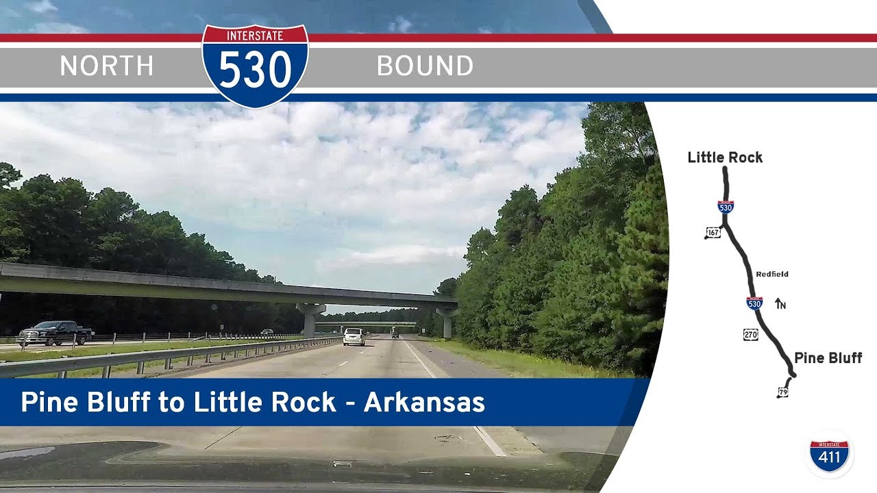
Take a northbound cruise through the Arkansas Delta as we follow Interstate 530 from Pine Bluff to Little Rock. This 42-mile run traces the spine of the U.S. Highway 65 corridor, starting in the heart of Jefferson County and ending at the confluence of major interstates in Arkansas’s capital. Along the way, we’ll pass pine groves, bypasses, and towns that still carry the pulse of regional rail, river, and agriculture economies.
Our drive begins on the southwest side of Pine Bluff, where U.S. Highway 79 feeds us onto the I-530 loop. This section, forming the western bypass of the city, offers a quick escape from Pine Bluff’s urban grid. To the right lies the edge of the Bayou Bartholomew floodplain—the longest bayou in the world—and to the left, a network of residential streets and small commercial zones. Within minutes, we reach the junction with U.S. 65 Business, the former route before the interstate bypass reshaped local traffic patterns in the 1980s. It’s a good place to reflect on how this corridor has evolved—first as a gravel road, then a U.S. Highway, and now a full-fledged Interstate feeding into Little Rock.
Leaving the city, the scenery begins to shift. At White Hall, U.S. 270 briefly joins us from the west before splitting off toward Sheridan and Hot Springs. This interchange marks the gateway between Pine Bluff’s outer suburbs and the rolling forests of rural Jefferson and Grant Counties. North of here, traffic lightens, the tree cover thickens, and we pass a few access points like AR-104—serving the National Center for Toxicological Research—before hitting the Redfield interchange at AR-46. Redfield itself is a modest but longstanding town, where timber and agriculture have played leading roles for generations. While we don’t leave the freeway, you can almost feel the historical rhythm of train tracks, sawmills, and the Arkansas River tugging gently from the east.
Crossing into Pulaski County, the landscape begins to subtly tilt toward the metropolitan. A left-side entrance ramp from U.S. 167 catches the eye—it’s a vestige of the original U.S. 65 alignment before Interstate 530 was fully realized. This section feels wider, smoother, and more refined. As we continue north, the name “Granite Mountain” may not sound like much, but this gentle grade down into the Little Rock basin gives us our first glimpse of industry and sprawl. Railroad yards, quarries, and utility infrastructure dot the margins, and soon the tree line gives way to development. We pass near Wrightsville and Woodyardville, where correctional and industrial complexes mark the southern edge of metro Little Rock.
The drive concludes at one of the state’s busiest junctions—the split between Interstate 30, I-440, and the southern loop around the city. As we merge into I-30 eastbound, we’ve completed a trip that bridges Arkansas’s second-largest city and its capital. From pine woods to concrete jungle, I-530 stands as a vital link—moving freight, connecting workers, and keeping the lifeblood of southern central Arkansas in motion.
🗺️ Route Map
0 Comments