![U.S. Route 67: Walnut Ridge to Pocahontas | Real Roads, Real Drives [Revisited]](https://openroadarchive.com/wp-content/cache/flying-press/8225c3565badd153f7844146dee7c3cf.jpg)
Take a relaxed ride across the northeast corner of Arkansas as we follow a smooth, steady stretch of U.S. Route 67 from Walnut Ridge to Pocahontas, a short journey that quietly bridges the Arkansas Delta with the opening foothills of the Ozarks. This is one of those drives where the scenery doesn’t change all at once, but gradually, almost rhythmically, as the land begins to lift and the tree lines thicken. It’s a dependable four-lane corridor—modern, wide, and familiar to anyone who travels this region—but it also has a subtle charm in the way it reveals two of Arkansas’s distinct landscapes in a single, compact run.
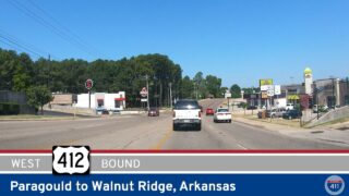
We begin the drive at the busy interchange where U.S. 67 meets U.S. 412 in Walnut Ridge, a regional crossroads that funnels traffic east toward Paragould and west toward Hardy and the Spring River. Walnut Ridge has long been a transportation hub, shaped first by the Frisco railroad and later by the construction of these major U.S. routes, and the city still bears that identity today. As we merge onto northbound 67, the road immediately settles into its four-lane, divided format—broad medians, gentle rises, and long views across open ground. Light industry, agricultural businesses, and roadside service centers line the early stretch, all tied to the regional economy that gives Walnut Ridge its steady pulse.
Leaving the city limits, the character of the landscape becomes more open. The flat Delta farmland stretches outward in every direction—broad fields cut by irrigation ditches, scattered barns, and the occasional grain operation rising above the horizon. It’s a landscape defined by space, one that feels wide and uncluttered, with the highway supporting a mix of local traffic, commuters, and long-distance travelers moving between the Missouri Bootheel and central Arkansas. Even as 67 maintains its expressway alignment, the pace feels unhurried, and each mile north gives us another long look across the rural patchwork that shapes life in Lawrence County.
The shift toward Randolph County comes quietly but noticeably. The ground begins to roll ever so slightly, lifting the horizon and bringing wooded patches closer to the roadway. Farmland remains a major presence, but the fields are edged more frequently by tree lines, and the terrain feels less uniform. The changes are subtle—small grades, trimmed banks, slopes that catch the sun differently—but together they signal that we’re edging out of the Delta and into the transitional fringe that leads toward the true Ozarks farther west and north.
As we continue north, the highway’s rhythm stays consistent, but the atmosphere grows more rural. The spacing between access roads increases, homes sit deeper off the right-of-way, and long stretches pass with only the hum of the tires and the changing landscape for company. It’s a clean run—straight, smooth, and designed for efficiency—but one that still gives us an unfiltered sense of northeast Arkansas’s geography as it gradually evolves.
Approaching Pocahontas, signs of a larger community begin to appear. Businesses gather near the southern outskirts, serving both highway travelers and residents from surrounding rural areas. Local access roads reconnect with the corridor, and traffic grows slightly thicker as we near the city. Though we don’t enter the historic town center on this route, it lies just a short distance north along U.S. 67 Business, home to a preserved courthouse square and access to the Black River, a staple of local recreation and history. The modern alignment continues straight ahead, carrying us toward one of the region’s most important junctions.
The drive concludes at the interchange with U.S. Route 62, a major east–west highway that leads west toward Imboden, Ravenden, and the Spring River corridor, or east toward the lowlands near Maynard and beyond. This meeting of 67 and 62 forms one of the anchors of Randolph County’s transportation network—a crossroads tying together Delta farmland, Ozark foothills, and the communities that bridge them. Our arrival here marks the end of a short but meaningful segment, one that reveals the understated beauty of this transition zone between two iconic Arkansas landscapes.
In the end, this segment of U.S. 67 doesn’t try to be dramatic; instead, it delivers a dependable and quietly scenic link between Walnut Ridge and Pocahontas, carrying us from open Delta fields to rolling ground with a sense of ease and continuity. It’s a drive that feels familiar to locals and refreshing to first-time travelers—simple, smooth, and unmistakably northeastern Arkansas.
🎵 Music: Track List
Music from this video may be available for purchase at https://theopenroadcollective.com
🗺️ Route Map
0 Comments