Take a short but telling drive through the Ozark foothills as we follow James F. Epps Road—Branson’s Yellow Route—from MO-248/Shepherd of the Hills Expressway to Roark Valley Road. In just 1.2 miles this connector road weaves together shopping centers, schools, wooded hillsides, and creekside parkland, showing how Branson’s color-coded bypass system balances visitor traffic with local life.
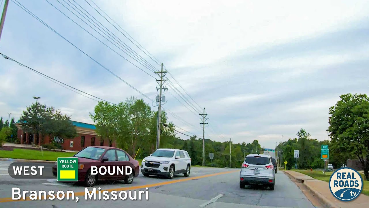
We begin at the busy junction with the Shepherd of the Hills Expressway, a corridor that carries much of the city’s through-traffic. Turning onto Epps Road, the first blocks set the stage for the road’s dual purpose: easing congestion while keeping daily destinations within reach. On the right rises a shopping center serving both residents and tourists, while just ahead sits the entrance to a local school. Here the Yellow Route doesn’t feel like a bypass so much as a neighborhood road, reminding us that Branson’s circulation system was designed with community in mind, not just convenience for travelers.
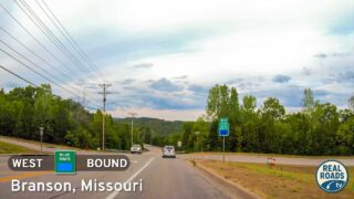
South of the school the tone changes as the pavement drops into a wooded slope. The grade is steady, the curves gentle, but the canopy thickens to create a sense of retreat from the city bustle. In summer, branches knit together overhead, filtering sunlight into shifting patterns on the asphalt. Through autumn, these same trees blaze in gold and scarlet, offering a quick seasonal spectacle for anyone cresting the hill. Halfway down, the signed turn for Stockstill Park appears—a green refuge that locals treasure for ballfields, picnic spots, and walking trails along Roark Creek. Just beyond, the roadway snakes through a memorable S-curve, carving gracefully into the valley floor.
At the base of the hill, this segment of the Yellow Route reaches its natural conclusion: a crossing of Roark Creek before joining Roark Valley Road, Branson’s Blue Route. This junction is more than a stop sign; it’s a hand-off between two of the city’s key relief roads. Westbound leads toward Gretna Road and the theater corridor, eastbound loops back toward neighborhoods and services, and straight ahead lie entertainment venues and resort clusters. The sequence of settings—urban services, school frontage, wooded descent, park access, and creek crossing—captures Branson’s layered character.
Though brief, James F. Epps Road feels like a sampler of the Ozarks’ blend of natural beauty and human use. It carries commuters, ushers visitors, and links one bypass to another—all while threading through hills and hollows shaped by water and stone. In less than two miles, the Yellow Route reminds us that even the shortest connectors can tell a story of how a city adapts its landscape to serve both community and travelers.
🎵 Music: Track List
Music from this video may be available for purchase at https://theopenroadcollective.com
🗺️ Route Map
0 Comments